

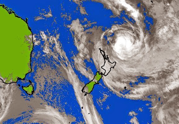
As I said yesterday, tropical cyclones weaken as they move over the cooler waters around New Zealand, and this one was no different. However, it started out as a Category 5, which is the strongest, and it was still a Category 4 when it started to affect New Zealand. It weakened pretty rapidly from there—Cat 3 by midnight, and by this morning it was downgraded to an “ex-tropical cyclone”.
Such storms are still powerful, though, and can cause a lot of damage through wind, rain and storm surges. Emergency serves in the northeastern part of the North Island are mobilised.
There was very little damage reported in Auckland and Northland. About 2000 people were without power, but most of that had been restored by this morning.
For Auckland, storms called “weather bombs” (also caused by a tropical depression) usually wreak far more havoc than cyclones. A weather bomb in 2007 blew a tree onto our house, and one last year was bad. There was also one in 2008, but one in 2010 didn’t amount to much. One reason that weather bombs are a bigger deal is that they hit New Zealand far more frequently than tropical cyclones do.
Tropical cyclones are a concern mostly in later summer and early autumn, weather bombs in late autumn or winter. While bad storms can, at least theoretically happen any time, we seem to be at the greatest risk for roughly the next five months or so.
This time, Auckland and Northland got off lightly. Hopefully the rest of the country will, too, and once the threat’s over, we can again turn our attention to helping our Pacific neighbours recover. But for all of us, this won’t be the last time.
Related: The New Zealand Herald is publishing Live Updates on the storm’s progress past New Zealand, and has also published a wrap-up of how the storm has affected different regions of the country.
The photo up top is an image of the storm from MetService at 7am this morning, and, for comparison, the one below is from 9pm last night.
No comments:
Post a Comment